Underground Utility Locating
Near Milwaukee, WI
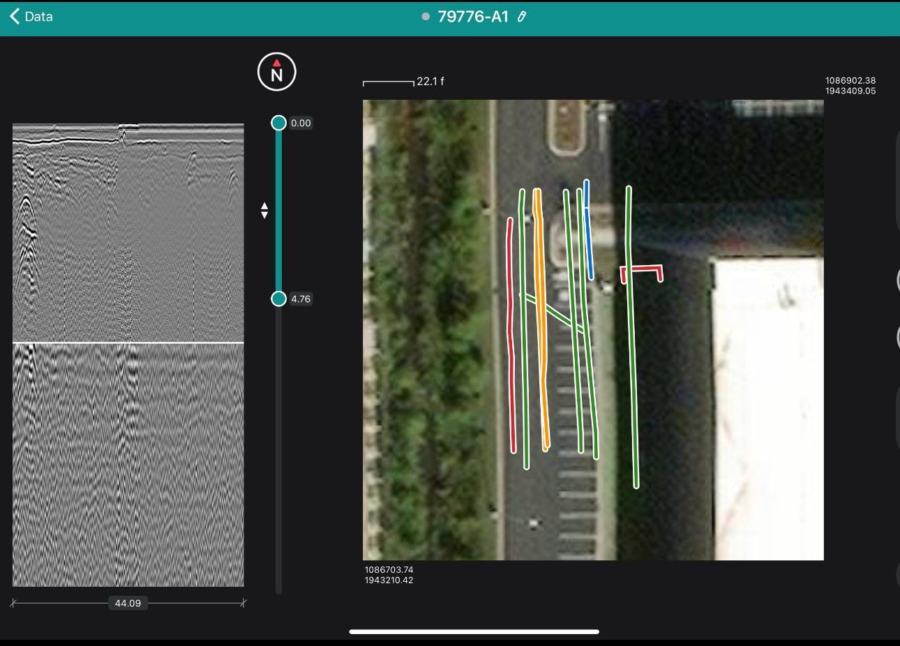
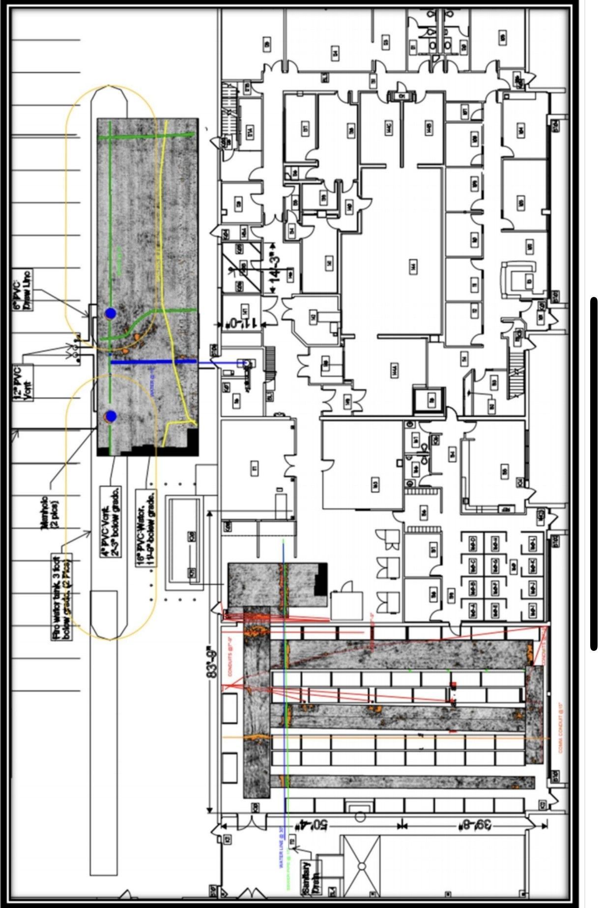
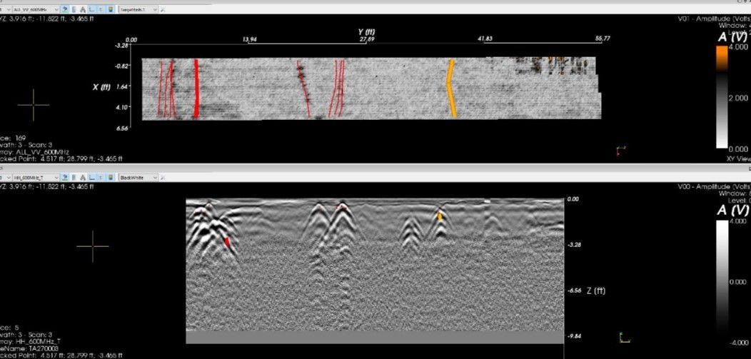
Concrete Imaging Data
Utility mapping & utility locating services identify and mark underground utilities such as water pipes, gas lines, electrical cables, and telecommunications cables. This is done to prevent accidental damage to these utilities during construction or excavation projects.
Private utility locating is typically performed using specialized EM and GPR equipment to accurately locate and mark the utilities' positions. This helps ensure the safety of workers and the integrity of the utilities.
Our experts can perform the following types of locates:
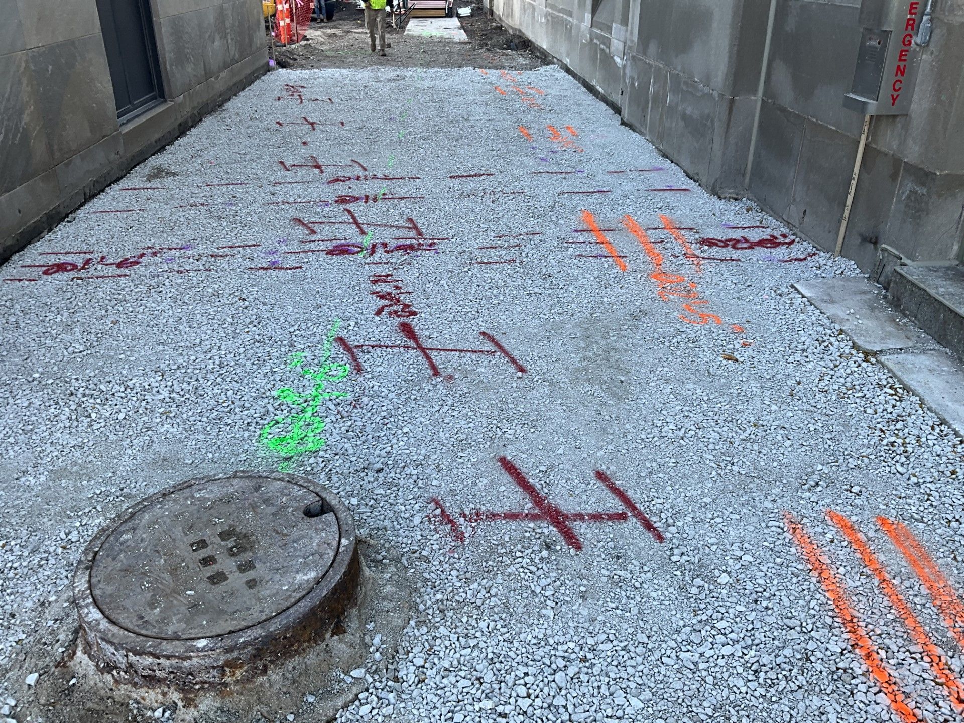
- Private Utility Locating: Private utilities are utility lines that are not owned or maintained by the public utility companies. These can include lines for private water, sewer, gas, or electrical systems. To locate private utilities, you may need to hire a private utility locating company or consult with a professional surveyor who specializes in private utility locates.
- Secondary Utilities: Secondary utilities are utility lines that are not considered primary or essential services but still need to be located before excavation. These can include lines for irrigation systems, landscape lighting, or private communication lines. Contact the relevant service providers or consult with a professional to locate these secondary utilities.
Where We Work
We have 4 locations spanning from Wisconsin to Northern and Central Illinois. Find out more about each location and how to contact us.

Utility locating experts near Milwaukee, WI
During a concrete bridge deck inspection, several key areas are thoroughly inspected to assess the condition and integrity of the structure. These areas typically include:
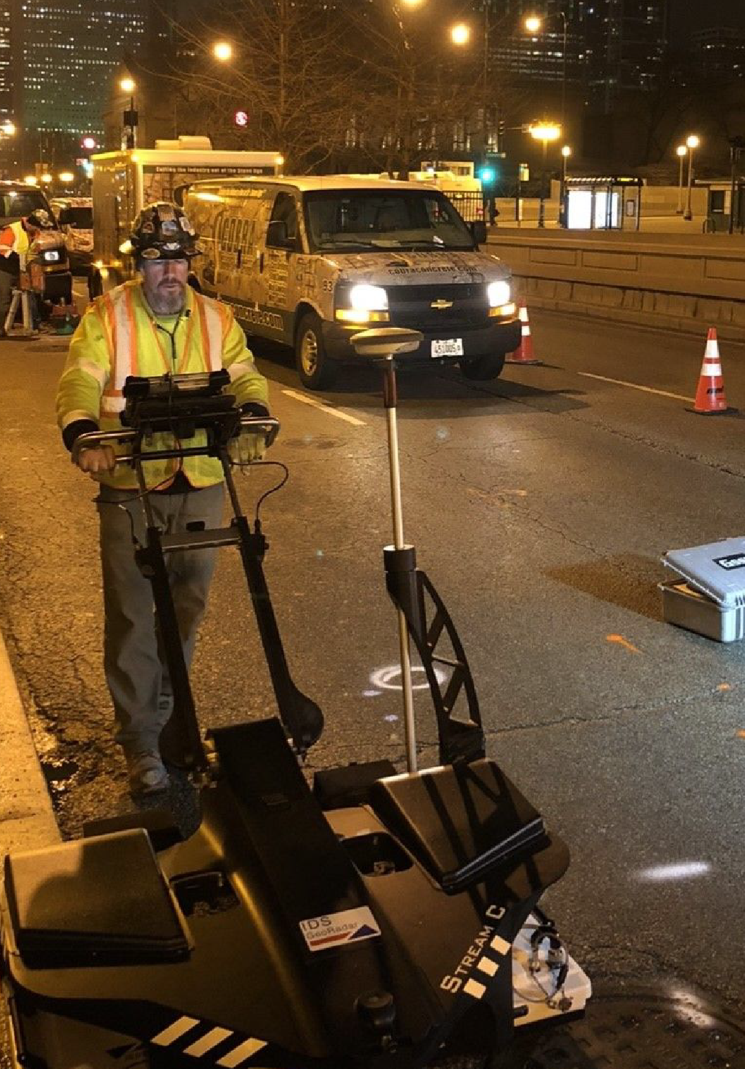
stream c- multi channel gpr
To obtain the highest level of certainty when performing a Utility Locate, a Multi-Channel GPR unit can be used. The power of the system is that it can collect data in both directions with one pass. It can also locate trenches, voids, and buried train tracks.
Utility Locating Service Specs:
em locate Depth
10' or greater
Type of Cut
Straight Cut
Materials Cut
Concrete, Asphalt, Soil, Gravel etc.
Powered By
Ni/Cd or Li-ion battery
Dust control method
Yes
Best For:
Locating private utilities, buried tanks, unmarked graves, tree root systems, etc.
Receive a FREE Quote On Your Next Job
We pride ourselves on our commitment to complete client satisfaction and safety, and we have the reputation and track record to prove it.
Why Choose Us
We revolutionize the concrete sawing & drilling industry through our innovation & attitude, provide a level of service & passion that our customers, our employees & our community desire to experience.
Safety
Cobra emphasizes the importance of safety from start to finish of every project.
Relationships
Creating successful relationships while building trust during completion of all current projects and beyond.
Innovation
Better solutions and ideas to complete projects in a more timely and efficient manner.
Google Reviews
james hertz

I used to work with the owner's father for many years, trusting the company with my life. They are committed to fair pricing and completing the job on time, often ahead of schedule—more so than anything else.
Request a Quote
Thank you for your interest in our utility locating services near Milwaukee, WI! We pride ourselves on our commitment to complete client satisfaction and safety, and we have the reputation and track record to prove it.